
Southwest and Southeast Area Plans Submitted for Final Review and Adoption

The Southwest and Southeast Area Plan project teams have submitted their Final Draft Plans for review and adoption. Both plans will be introduced to the Common Council during the Tuesday, May 5, 2026, meeting.
Copies of the plans being submitted for review and approval are publicly available online on Legistar and the respective web pages for the Southwest and Southeast Area Plans.
Review the Southwest Area Plan
Review the Southeast Area Plan
After introduction, the plans will be referred to relevant Boards, Commissions and Committees, which may propose changes to the plans before the Common Council makes a decision on final approval.
Each Board, Commission and Committee meeting during the adoption process will provide the opportunity for public comment. Agendas and instructions on how to register for public comment — both spoken and written comments — are typically posted the Friday prior to each meeting. Agendas will be posted on the meeting notice pages linked in the timeline below.
Plan Adoption Timeline
About the Southwest Area
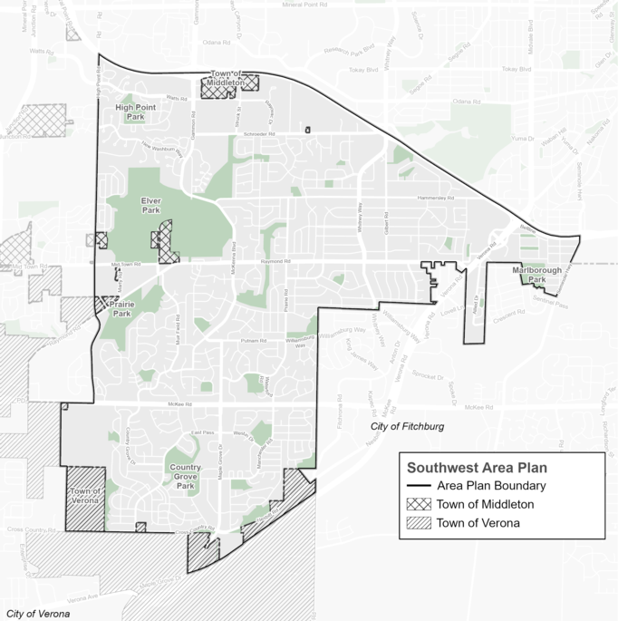
The Southwest Area Plan covers the area bounded by the Beltline Highway to the north, the City of Fitchburg to the east, South High Point Road to the west, and Highway 18/151 and Cross Country Road to the south. It is home to about 37,000 people and 7,500 jobs, containing about 13% of the city's overall population within about 10% of the city's total land area. Approximately 37% of the people living in this area identify as Black, Indigenous, and People of Color (BIPOC) or Latinx, making it one of the more racially diverse parts of Madison.
About the Southeast Area
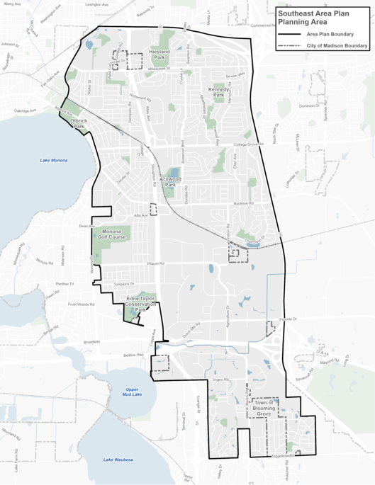
The Southeast Area Plan covers the area bounded by State Highway 30 to the north, Interstate 39/90 to the east, the City of Monona to the west, and Siggelkow Road/the Village of McFarland to the south. It is home to about 25,000 people and 17,000 jobs, making it a major employment hub for the city as a whole. The Southeast Area contains about 9% of the city's overall population within about 13% of the city's total land area. Approximately 26% of the people living in this area identify as BIPOC or Latinx.